
Flood Insurance in Franklin, TN: What Williamson County Homeowners Need to Know
Franklin, Tennessee sits inside one of Middle Tennessee's most active floodplains. The Harpeth River threads through Williamson County and has repeatedly shown it can overwhelm neighborhoods, roads, and homes that sit nowhere near its normal banks. With median home values well above $840,000 across the city—and luxury properties regularly exceeding $1.5 million—getting flood coverage right is not optional. It is essential. This guide covers every variable Franklin homeowners need to understand: FEMA flood zones, the 2010 disaster that rewrote local flood maps, NFIP versus private options, cost by zone, and why the standard federal coverage ceiling leaves most Williamson County homes dramatically underinsured.
Why Franklin, Tennessee Faces Serious Flood Risk
Flooding is the single greatest natural hazard facing Williamson County, and the Harpeth River is the primary reason. The river runs directly through the city of Franklin, draining a large upstream watershed that includes portions of Rutherford County. Its two main measurement points tell the story: the gauge on Murfreesboro Road near Pinkerton Park reaches flood stage at 30 feet, while the gauge below Franklin on Hillsboro Road near Judge Fulton Greer Park hits flood stage at 27 feet. Both gauges see local impacts even when official flood stage is not reached, according to the Williamson County Emergency Management Agency.
Beyond the main Harpeth channel, two tributary systems add to the risk: the West Harpeth, which drains the Leiper's Fork area, and Big East Fork, which collects runoff from the rapidly developing southeastern portions of the county. New development that converts farmland and open fields into impervious pavement accelerates runoff into these waterways, raising flood levels for existing downstream properties. As the Harpeth Conservancy has documented, FEMA flood models historically have not incorporated projections of increased rainfall intensity driven by climate change, meaning the maps used to set insurance requirements may continue to underestimate actual risk for years to come.
Williamson County's inland flood risk is rated Relatively Moderate by FEMA's National Risk Index, with an estimated annual expected loss from inland flooding of $57 million, according to FludZone's analysis of FEMA data. That figure reflects both the county's growth and the persistent vulnerability created by development patterns along the Harpeth corridor.
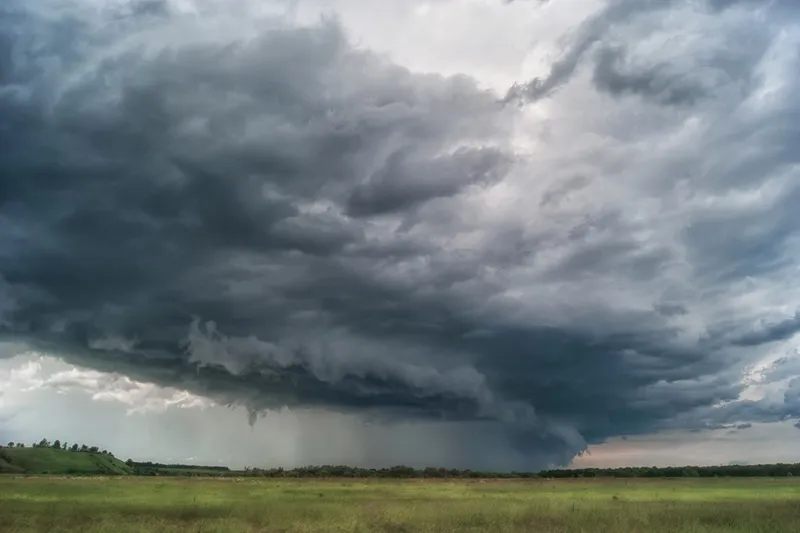
The May 2010 Flood: Franklin's Defining Water Event
No event better illustrates Franklin's flood exposure than the catastrophic rainfall of May 1 and 2, 2010. Back-to-back record-breaking storms dropped 13.57 inches of rain across the region in just two days—more than doubling the previous record for the Nashville area set in 1948, according to the National Weather Service. In downtown Franklin, the Harpeth River crested at 35.32 feet, narrowly exceeding the previous record of 35.14 feet also set in 1948.
The consequences for Williamson County were severe. According to the Harpeth Conservancy's retrospective, 1,500 residential and commercial structures were damaged across Williamson County, causing roughly $100 million in total damage. In the city of Franklin alone, close to 400 people were rescued and more than 440 structures were damaged. The City of Franklin closed 30 to 35 streets over that weekend, and the solid waste department collected a record amount of debris over the following seven weeks. Floodwaters covered Hillsboro Road, cutting off entire neighborhoods along the Harpeth bend. Subdivisions including Fieldstone Farms, Monticello, and Cottonwood—all built under earlier, less stringent floodplain rules—suffered significant inundation.
The 2010 flood forced an update to FEMA's flood maps for the entire Harpeth system. After the remapping, many property owners discovered their homes had been added to the 100-year floodplain or that more of their land now fell within it than before. Properties that appeared safe when they were built were suddenly facing mandatory flood insurance requirements from lenders.
FEMA Flood Zones in Franklin and Williamson County
Franklin's flood zones are primarily designated Zone AE and Zone X, the two most common designations found throughout the city. Understanding the difference matters because it directly determines your insurance obligation and your premium.
Zone AE is the high-risk Special Flood Hazard Area (SFHA). Properties here face at least a 1% annual chance of flooding—the so-called 100-year flood standard—and FEMA has calculated a specific Base Flood Elevation (BFE) for the area. If you have a federally backed or regulated mortgage and your property falls in Zone AE, your lender is legally required to ensure you carry flood insurance. Central Franklin and areas along the Harpeth corridor carry Zone AE designations. Williamson County currently has 901 active NFIP policies in Zone AE, with an average annual premium of $1,375, according to OpenFEMA policy data compiled by FludZone.
Zone X covers moderate-to-low-risk areas. No mandatory purchase requirement applies, but it is worth knowing that over 40% of all NFIP flood claims nationally come from Zone X properties. Franklin has 773 active NFIP policies in Zone X at an average premium of $814 per year. Zone X policies are often the most cost-effective flood coverage available and represent strong value relative to the risk they cover.
Williamson County has also been through an ongoing FEMA Flood Insurance Rate Map (FIRM) update that was nearing completion as of late 2023. When FEMA finalizes new maps, some properties will move into higher-risk zones while others may be reclassified downward. Any change to your FIRM designation directly affects your insurance requirements and premiums.
Key flood-prone areas and neighborhoods to watch in Franklin include:
- Fieldstone Farms – situated along a bend in the Harpeth that experienced aerial-level flooding in 2010; many homes were built under older, less protective floodplain standards
- Monticello and Cottonwood – both experienced significant flood impacts in 2010 and again in 2021; portions sit in or adjacent to Zone AE floodways
- Brownland Farm area / Hillsboro Road corridor – the large Harpeth bend here is over 80% floodplain, with floodway channels that historically overtop Hillsboro Road during major events
- Downtown Franklin near Pinkerton Park – the primary Harpeth gauge location; Zone AE extends along Fifth Avenue and adjacent streets
- West Harpeth / Leiper's Fork corridor – flash flooding risk from tributary streams is elevated here; roads were cut off in 2010 within hours of the storms beginning
Franklin's Community Rating System Discount
Franklin participates in FEMA's Community Rating System (CRS), a voluntary program that rewards communities for implementing flood mitigation measures that go beyond the minimum NFIP requirements. Franklin holds a Class 8 CRS rating, which entitles NFIP policyholders in the Special Flood Hazard Area to a 10% discount on their flood insurance premiums. Policyholders outside the SFHA may receive a 5% discount. This discount applies only to NFIP policies, not private flood insurance, and is already factored into the quoted rates you will receive through a federal-backed policy, according to the FEMA Community Rating System data for Franklin (October 2025).
NFIP Claims Data for Williamson County
The numbers behind flood insurance in Williamson County tell a clear story. Since 1978, the county has recorded 1,099 NFIP flood insurance claims totaling $30.8 million in payouts. There are currently 1,678 active NFIP policies in force, carrying an average annual premium of $1,121—meaningfully above the national average of $915, reflecting the county's genuine flood exposure, per OpenFEMA data.
The county also has 87 properties with multiple flood insurance losses, including 15 severe repetitive loss properties—homes that have experienced four or more NFIP claims of $5,000 or more, or two claims that together exceed the building's value. FEMA has funded mitigation for 26 properties in Williamson County at a total investment of $3.2 million, with 18 of those resulting in acquisitions (buyouts) and 7 resulting in elevation projects. These are not abstract statistics: they represent neighbors who have filed multiple claims on the same homes because the underlying flood risk was never fully addressed.
NFIP vs. Private Flood Insurance: Which Is Right for Franklin Homeowners?
Both the National Flood Insurance Program and private flood insurers write flood policies in Franklin, and each has meaningful strengths and limitations. The right choice depends heavily on your property's value, flood zone, and how much coverage you genuinely need to rebuild.
The NFIP (National Flood Insurance Program)
The NFIP is the federal program administered by FEMA and written through licensed insurance agents. It is accepted by all federally regulated mortgage lenders, available in all flood zones, and backed by the U.S. government. Since 2021, FEMA has priced NFIP policies under Risk Rating 2.0, which ties premiums to individual property characteristics—flood frequency, distance to water, elevation, and replacement cost—rather than simply zone designation. The result is more accurate pricing, but it also means many high-risk properties are seeing steady rate increases capped at 18% per year until they reach actuarially sound levels.
The NFIP's critical limitation for Franklin homeowners is its coverage ceiling. The program covers a maximum of $250,000 for the residential building and $100,000 for contents, with no coverage for temporary living expenses, finished basements below grade, landscaping, or decks. In a market where the median Franklin home sells for approximately $840,000 and luxury properties routinely exceed $2 million, a $250,000 building limit leaves most homeowners holding an enormous uninsured gap.
Private Flood Insurance
Private insurers can write flood coverage with building limits of $1 million or more, contents limits above $500,000, and endorsements that cover additional living expenses, basement contents, and replacement-cost valuation on personal property. Premium pricing from private carriers is often competitive with or below NFIP rates, particularly for Zone X properties and well-elevated homes. According to Policygenius data, the average private flood insurance premium in Tennessee is approximately $632 per year—notably lower than the NFIP Tennessee average of around $1,153.
Private policies are accepted by most lenders as satisfying mandatory purchase requirements when they meet federal standards. The primary caution: availability can be more limited in the highest-risk Zone AE areas, and coverage terms vary more widely between carriers than under the standardized NFIP policy. Private policies also typically offer faster claims processing—averaging around 14 days versus roughly 89 days for NFIP claims, per industry data.
Excess Flood Coverage for High-Value Homes
Franklin's real estate market makes excess flood coverage a particularly important topic. For homes valued above $500,000—a description that fits the majority of new construction in many Franklin neighborhoods—neither the NFIP limit nor a standalone private policy may fully cover replacement cost. An excess flood policy sits above a primary policy (either NFIP or private) and activates once the underlying limit is exhausted. A typical structure might pair a $250,000 NFIP base policy with a $750,000 excess policy for $1 million total coverage. Excess policies generally carry no deductible of their own since they only trigger after the primary policy pays its maximum, according to Novatae Risk Group.
Flood Insurance Cost Comparison: Franklin, TN
The table below summarizes typical annual premium ranges for common Franklin property scenarios under NFIP versus private flood insurance. Actual rates depend on the specific Risk Rating 2.0 assessment, elevation certificate data, deductible selection, and carrier. These ranges are intended as a planning benchmark, not a binding quote.
| Property Type | Flood Zone | Coverage Amount | NFIP Est. Annual Premium | Private Est. Annual Premium |
|---|---|---|---|---|
| Single-family home (entry-level) | Zone X | $250K building / $50K contents | $500–$900 | $350–$700 |
| Single-family home (mid-market) | Zone AE | $250K building / $100K contents | $1,200–$2,400 | $900–$2,000 |
| High-value home | Zone AE | $500K building (private) / $150K contents | N/A (exceeds NFIP max) | $2,000–$4,500 |
| Luxury home ($1M+ replacement cost) | Zone AE | NFIP $250K + excess $750K | $1,375 base + excess premium | $3,000–$6,500 (standalone private) |
| Townhome / condo (contents only) | Zone X | $100K contents | $400–$700 | $300–$550 |
Sources: OpenFEMA policy data via FludZone (March 2026); LendingTree flood insurance cost analysis (2025); Bankrate NFIP cost data (July 2025). Ranges reflect typical residential scenarios and are not guaranteed rates.
Why NFIP Limits Fall Short in Franklin's Housing Market
Franklin is one of the most expensive housing markets in Tennessee, and the pricing trajectory points only upward. The median home sale price in Franklin reached approximately $840,000 in early 2026, up 3.3% year over year, according to Redfin market data. In the 37064 zip code, the median listing price has crossed $1.17 million, according to Realtor.com data. Luxury subdivisions such as Westhaven, McLemore, Southall, and Seward Hall routinely see transactions above $1.3 million.
The NFIP's $250,000 building limit was last updated decades ago and has never kept pace with construction costs in high-growth markets. In Franklin, where replacement cost for a custom-built home can reach $400 to $550 per square foot, a 2,500-square-foot structure can easily require $1 million or more to rebuild from scratch. A homeowner relying solely on NFIP coverage could face a $750,000 out-of-pocket gap after a total flood loss—a scenario that is not hypothetical in a county with 15 severe repetitive loss properties on record.
The Kings of Real Estate team at Your Home Sold Guaranteed Realty (YHSGR) has observed that buyers in Tennessee's luxury segments are increasingly asking about flood zone status before closing, recognizing that ongoing insurance costs and resale implications make flood zone placement a material factor in a purchase decision. Getting the right coverage in place before you close—rather than after a loss—is always the better outcome.
The 30-Day Waiting Period: Why Timing Matters
One rule catches many Franklin homeowners off guard: standard NFIP flood policies carry a 30-day waiting period before coverage takes effect. Policies obtained in connection with a real estate closing are an exception (coverage generally begins on the loan closing date), but if you simply decide to add flood insurance before a storm season or after watching local rivers rise, you cannot buy coverage and have it active the same day. Private flood policies may offer shorter waiting periods—sometimes as few as 10 to 14 days, though terms vary by carrier. Planning ahead is the only strategy that works.
About All Seasons Insurance Group
All Seasons Insurance Group (ASIG) is a Tennessee-based independent insurance agency serving homeowners across the state. As an independent agency, ASIG can shop multiple carriers—including both NFIP-backed flood policies and private flood insurers—to find coverage that fits each client's specific flood zone, property value, and budget. For Franklin and Williamson County homeowners navigating the complexity of Zone AE requirements, NFIP limits, and excess flood options for high-value properties, working with an independent agency means you get an objective comparison rather than a single-carrier recommendation. ASIG can be reached through asigtn.com.
Frequently Asked Questions
Is flood insurance required for homes in Franklin, Tennessee?
If your Franklin property is in a Special Flood Hazard Area (SFHA)—designated Zone AE or Zone A—and you carry a federally regulated or government-backed mortgage, federal law requires your lender to ensure you maintain flood insurance for the life of the loan. Properties in Zone X carry no federally mandated purchase requirement, but over 40% of all NFIP flood claims nationally come from outside the SFHA. Coverage is strongly recommended regardless of zone designation.
What flood zones exist in Franklin, TN?
The most common FEMA flood zone designations in Franklin are Zone AE (high-risk, Special Flood Hazard Area with calculated Base Flood Elevation) and Zone X (moderate-to-low risk). Zone AE is concentrated along the Harpeth River corridor, including sections of downtown Franklin, Fieldstone Farms, Monticello, Cottonwood, and the Hillsboro Road/Brownland Farm area. Zone X covers much of the developed higher-elevation portions of the city. FEMA's Flood Insurance Rate Maps for Williamson County have undergone revision following the 2010 flood, and a new updated FIRM was nearing finalization as of late 2023. You can verify your specific property's designation at FEMA's Flood Map Service Center at msc.fema.gov.
Does the NFIP provide enough coverage for a high-value Franklin home?
For most Franklin homeowners, the NFIP alone does not provide sufficient coverage. The NFIP caps residential building coverage at $250,000 and contents at $100,000. With the Franklin median home sale price around $840,000 and luxury properties regularly exceeding $1.5 million, a total flood loss would leave the typical homeowner with a very large uninsured gap. Options to bridge that gap include a standalone private flood policy (which can offer $1 million or more in building coverage) or an excess flood policy layered on top of a base NFIP policy. An independent insurance agent can compare both structures and identify the most cost-effective path to full replacement-cost protection.
How much does flood insurance cost in Franklin, TN?
Williamson County's average NFIP annual premium is $1,121, above the national average of $915. Zone AE policyholders in Franklin average $1,375 per year through the NFIP, while Zone X policyholders average $814 per year. Private flood insurance in Tennessee averages roughly $632 per year according to industry analysis, though high-value homes in Zone AE will cost more regardless of the carrier. Franklin participates in FEMA's Community Rating System at a Class 8 rating, giving SFHA policyholders up to a 10% discount on NFIP premiums. Actual rates depend on your property's elevation, distance to water, replacement cost, and deductible selection under FEMA's Risk Rating 2.0 methodology.
Can I get flood insurance if my Franklin home is in Zone X?
Yes. Both NFIP and private flood insurance are available for Zone X properties in Franklin. Zone X policies typically carry significantly lower premiums than Zone AE—NFIP Zone X policies in Williamson County average $814 per year. Given that flood events routinely impact properties outside the official high-risk zone (as the 2010 disaster demonstrated throughout Williamson County), purchasing flood coverage even in Zone X is a sound financial decision. The cost of a Zone X policy is modest relative to the potential loss from even a few inches of water intrusion.
About the Author
All Seasons Insurance Group is a locally owned, independent insurance agency proudly serving Tennessee families and businesses since 2021. Founded by Tannor Giles and Preston Stewart, our licensed team is committed to finding the best coverage at competitive rates — because as an independent agency, we shop multiple carriers on your behalf to get you the right policy, not just the cheapest one.
With offices in Sevierville (1001 Parkway) and Knoxville (121 Suburban Rd), we specialize in home, auto, business, farm, renters, and investment property insurance across East Tennessee — from the Smoky Mountains to Nashville.
Ready to review your coverage? Call us at (865) 263-1400 or get a free quote online.
Seasons change. So should your coverage.